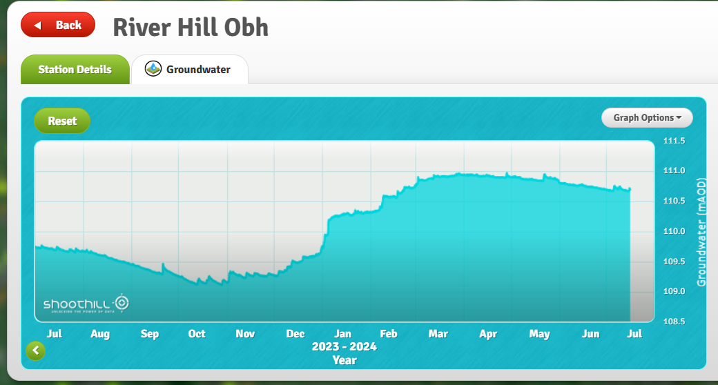
To check groundwater levels there’s a real time reading from River Hill near Flamstead. This is good for a general perspective but we have been warned that the equipment can occasionally be affected by heavy rain. Also useful are the readings from Ballingdon Farm at the top of the Ver catchment and Gorhambury but these are only updated every few months. Zooming in on this map will reveal river levels and even more groundwater and rainfall monitoring data points in the Ver Valley: EA Hydrology Data Explorer
